Day 53 – the Goolwa Barrage and Lock

5 kilometres from the mouth and the end of the trip. (The real mouth that is) Left with just enough light to see.  Cloudy,  raining but calm. Paddled straight past Goolwa and to the barrage.  I had one moment of emotion as I paddled to the barrage but it was pretty cold and it soon left me. This was the end of a years planning and 53 days of solid work.  I could see the salty stuff on the other side and it didn’t look all that inviting. Paddled back to Clayton’s Bay via the Wharf.

6 hours in all.  I felt pretty good after a shower and a warm up.  It’s amazing how bodies can adapt. image image

Thank You’s

24111400

Thanks to the family for putting up with my crazy plan.
Thanks to the Monday kayak guys who introduced me to Victorian rivers and lakes and Kayaking generally.
Thanks to Rob for watching out for me,  the lending of gear and moral support along the way.
Thanks to Mel Taylor for getting me fit enough to even think about a thing like this and the advice along the way.
Thanks the Elizabeth and Toni for the medical advise.
Thanks to Grant and his friends for finding my phone and chasing after me.
Thanks to the two young geezers (later to become 3) and the info you shared.  Truly impressive paddlers.
Thanks to the makers of SPOT.  Makes solo trips like this possible.  It should be used more widely.
Thanks to the residents of the Clayton’s Bay caravan park.  Hospitality at its best.
Thanks to the Victorian Sea Kayak Club. Great organisation and great people in it.
Thanks to Rohan and East Coast Kayaks for the magnificent machine.

Thanks to the Broadmeadows Pool for allowing me to practice safety drills.

Overview map

The overall average was just above 40 kilometres per day,  which includes rest days. The total distance was 2160 Kilometers.

The things that stand out in my mind are the generosity of people,  the fragility of the river,  especially the banks,  and the birds.  The amazing pelicans.

Thank you for your interest.

Day 51 Clayton’s Bay

15 kilometres from the mouth.

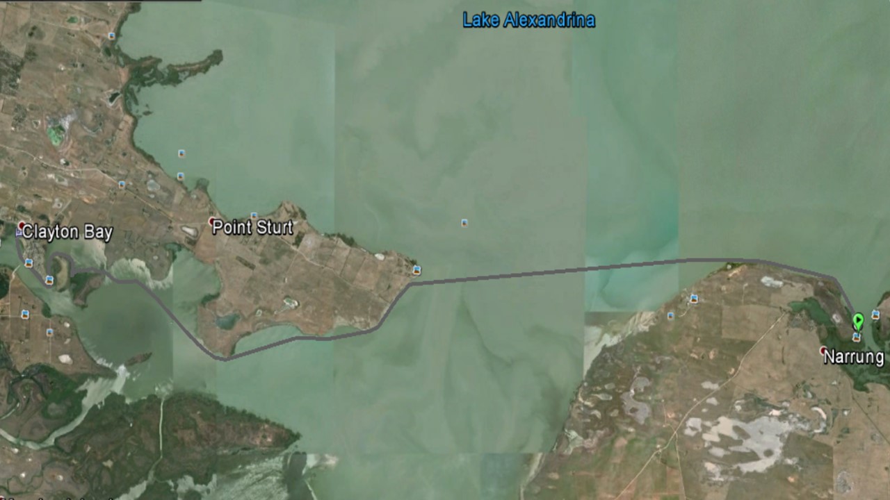
Left at daylight.  Conscious of the open water bit.  It was a little rougher but landed just south of Point Sturt after 2 and a half hours.

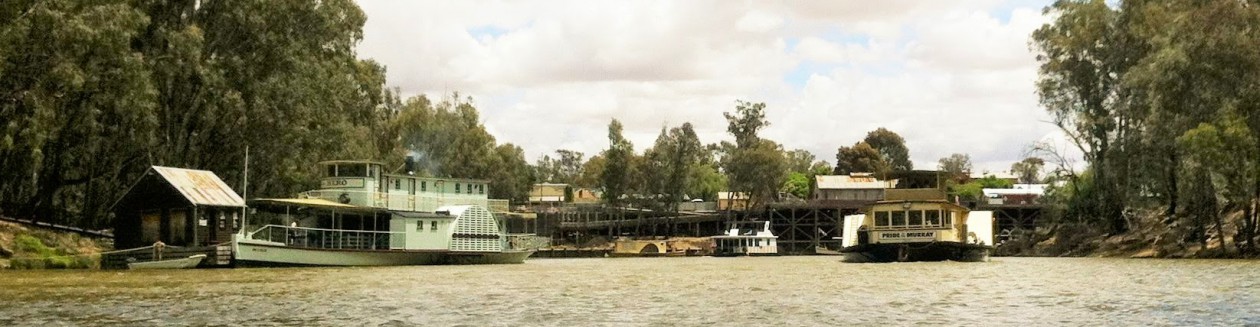
This was taken by Aaron. One of the young geezers.

IMG_2169

Narung to Claytons Bay

Followed the coast to keep out of the westerlies and had lunch at a point past Point Sturt. I could see the houses of Clayton’s Bay and Hindmarsh Island far in the distance and looking back, the open water of Lake Alexandrina towards Narung. Just myself and the environment for kilometers. In a few hours that would be over. I thought about that for some time. Sitting on shore, or in the magnificent machine, watching the birds and animals, and the river, would be over. While I loved the caravan parks, the towns and the people, the sadness that it would be over, as soon as I left that point, got to me. Getting to Goolwa and the barrage was important, but emotionally, leaving that world, affected me the most.

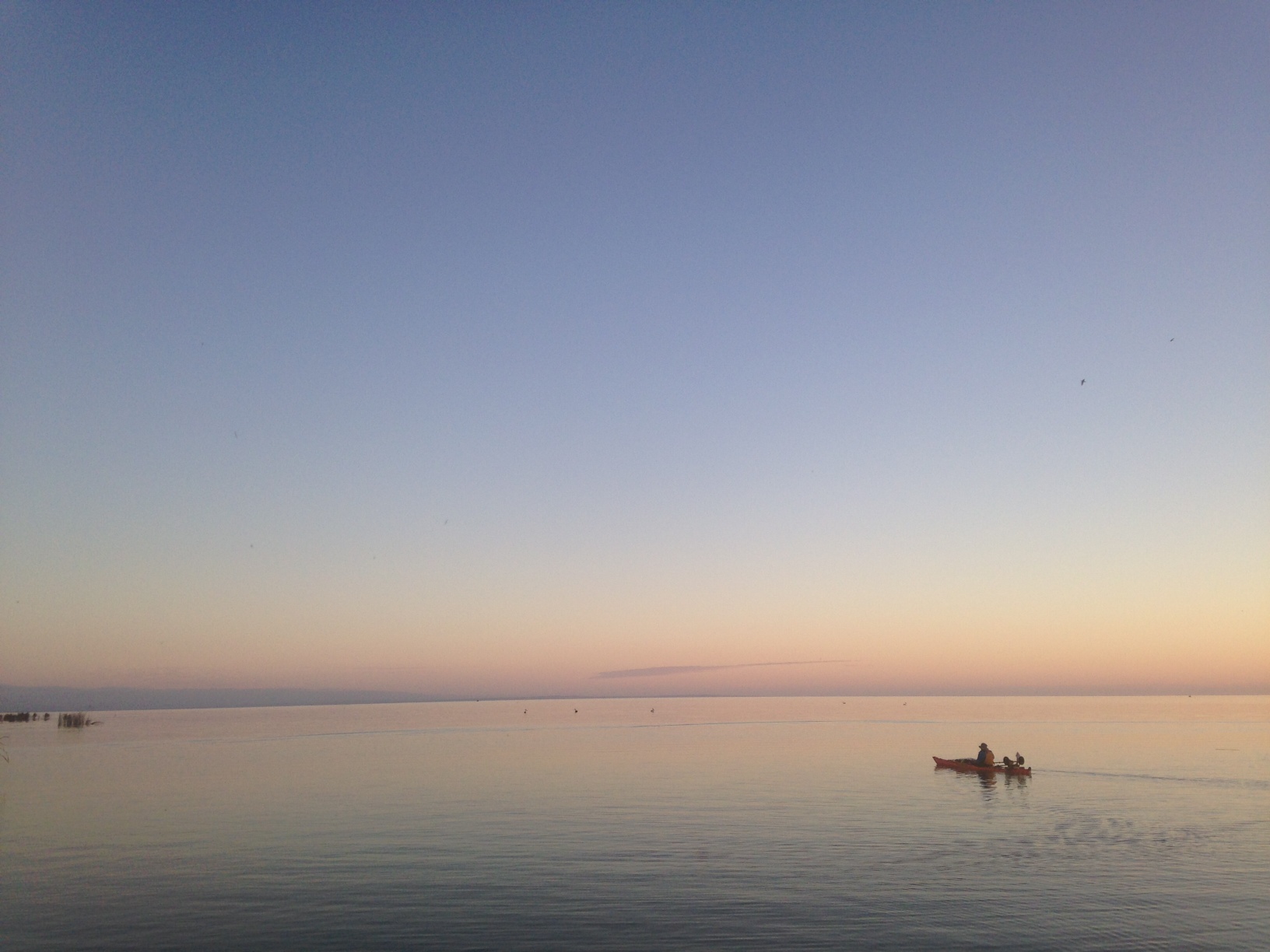
Looking back East to Narrung

image

Looking towards Clayton’s Bay

image

Camp Clayton

image

Averages etc are incorrect as I had to turn the gps off and on because no batteries left.

image

Day 50 Narrung

Approx 30 kilometres from the mouth.

Challenging day.  Left about 10 and unpacked  the magnificent machine to get down the bank  at the back of the pub without breaking anything.
Got to the end of the channel about to enter  the Lake proper and contacted my three compatriots who left Murray Bridge earlier.  I decided to go ahead as the northerly was blowing and no paddling was necessary.  I set a bearing for Narrung but kept  the east coast about 400 meters off. Until I had a large bay to cross and decided to stick with the wind.
At some stages it was full left paddle,  plowing a groove in the water and still doing 8 to 9k. Eventually the wind died and changed.  This meant two wave patterns meeting with peaks.  Plus I had to start paddling.  After a while,  somehow I ended upside down.  No sure how but there you go.  Went through the paddle float process with getting in upside down,  pumped it out with the bilge pump and paddled over to the bank.  Had something to eat and headed off.
Lost half my spare paddle and the phone because the aquapack failed.  Good outcome really.

The track across the Lake

Lake Alexandrina Day 1

Beautiful camp site.  Free camp as well.

image

image

Sound asleep and I hear my name being called from outside.  The guys from Murray Bridge arrived,  incredible effort.

image

Day 49 Wellington

80 kilometres from the mouth. 

Nearly there,  just gotta keep telling my self it’s not done yet.
Good northerlies this morning but they died later in the day.
Long relatively straight reaches.  Rained a little and more predicted for tonight.

image

This bank is at the back of the Wellington pub.  Across the road from the pub is the caravan park.  I have no video of me getting the magnificent machine up this bank but I’m sure you can imagine.  It’s not the paddling or the snags or the dangerous cuttings that did me in but this bank came close. 
Camp Wellington

image

Not sure how tomorrow is going to pan out but I think I will go for the first camping spot with is Pomanda Point and review the situation.  Been in contact with Aaron and Macca and we may all go across together. Tomorrow afternoon and Wednesday will be good weather wise for the broader area.  Tomorrow morning has good northerlies for the channel to the first point

image

.

Day 48 Murray Bridge

114 kilometres from the mouth.

Fairly undecided about moving on last night.  For a couple of reasons.  I needed more supplies and a bit of rest and planning to prepare for the lake.
I woke early and decided to take off.  Dark and  some light rain but no wind to speak of,  so excellent paddling conditions.
Tomorrow I think will be northerlies,  so all good for Wellington.
Tonight I am in  a marina/caravan park on the downstream side of Murray Bridge.  Bit low on food but still ok,  no shops nearby.  The lady in the park office has kindly given me some eggs which are going to be breakfast.
I have been doing washing at every caravan park as I have very few clothes.  Lucky am able to do this as the air is very damp at  night.  My routine is very set at each night with two variances, caravan park or rough camp. 

On the way today

image

The expanses of  water are huge.  Pretty hard to get it in perspective.

image

Looks like my body is programmed for 40 k days.

image

Day 47 Mannum

154   Kilometres from the mouth.

Perfect day for paddling although it started with me have to run on instruments.

image

Could see  just enough so I didn’t run into anything but had to use the gps to see which way the river was going and where I was in the river. 
Later it got glorious

image

Then this set of ladders appeared.  You have to look carefully there is one up through a hole in the ledge.  No way would I go up or down it.

image

image

And then there was this.

After seeing few house boats yesterday,  they were everywhere today

image

You have to add 6k to that,  I forgot to reset it.  Also the elevation.  It’s where I took the picture, the cafe where I’m having dinner.

Day 46 near Caurnamont

201 kilometres from the mouth.

Well I tried to make it 199 but this where I ended up.

River has changed during the day.  The massive gouge out  of the flat plain has given way to rolling hills,  which has made the river a bit more windy.
I’m about half way to Mannum which means I have to  pull the same stunt tomorrow.
Passed a loose procession of river cruises on their way upstream.  Very quiet,  very well maintained and one, especially powerful.  Moving very fast and all I heard was the wash.  Many outboards have passed me but one stood out as very quiet on a small tinny.  It was too far away for me to get the brand but with it also I could only hear the wash and no motor noise. 
Huge houseboats,  a few moving or with people on board but most parked and unoccupied.
Large numbers of signs about private property,  no house boats,  no stopping,  freehold land and I doubt the veracity of some but one intreiged me,  “occupied land,  no entry”.
The cliff faces today we’re particularly sheer and long.  The sulphur crested cockatoos liked the little caves in them and we’re all over the cliffs.  As I came up to one they were going berserk,  leaving the cliff face and heading for the trees.  When I looked up two wedge tailed eagles were circling.  When I looked further up in the sky two pelicans were circling up in a thermal.  No doubt to fly off somewhere.  Also today saw two pelicans perched very high in a dead gum tree.  Would  have liked to see how it landed there.  Some what like landing a jumbo jet on a tennis court. 
Camp tonight is pretty good. 

image

image

Don’t believe the 11 top speed.  Must have been when I threw the gps on the deck.

image

Day 45 Swan Reach

Approx 244 kilometres from the mouth.

The interesting thing about this morning was that there was a dew.  First dew of the trip.  If I get too many of them I will be in some difficulty as my clothes won’t dry.
The river is almost Gunbarrel straight south and I’m glad I wasn’t trying to go down it a week ago.  There was some southerly today but not too bad.  The sky changed slowly during the day to a little more sunny with less cloud.

Sitting in the last lock..  Lock #1

image

The lock was at Blanchetown and on the lower side of the lock was huge numbers of pelicans.  I saw a group earlier in  the trip in a line lifting one wing up to shadow the water to see the fish.  They are fascinating birds.

Lots of very nice Queensland design houses on the downstream side on Blanchetown along with freehold shacks and camp grounds.

Up close and personal with a cliff

image

Just in case you have been wondering how I have been finding my way around.

image

Swan Reach town is great.  Lots of towns to come  back to.  Sitting in the hotel writing this after a meal overlooking the river and the ferry,  very nice.

image

Bike Ride to Sydney and Murray River Kayak trip.